


Bonbrook Voting District, Franklin County, Virginia
About
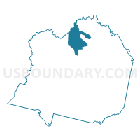
Outline

Summary
| Unique Area Identifier | 681699 |
| Name | Bonbrook Voting District |
| County | Franklin County |
| State | Virginia |
| Area (square miles) | 25.58 |
| Land Area (square miles) | 25.51 |
| Water Area (square miles) | 0.07 |
| % of Land Area | 99.73 |
| % of Water Area | 0.27 |
| Latitude of the Internal Point | 37.13072530 |
| Longtitude of the Internal Point | -79.87758540 |
Maps


Graphs
Select a template below for downloading or customizing gragh for Bonbrook Voting District, Franklin County, Virginia


Neighbors
Neighoring Voting District (by Name) Neighboring Voting District on the Map
- Boones Mill Voting District, Franklin County, VA
- Burnt Chimney Voting District, Franklin County, VA
- Clearbrook Voting District, Roanoke County, VA
- Cooper's Cove Voting District, Franklin County, VA
- Mount Pleasant Voting District, Roanoke County, VA
Top 10 Neighboring County Subdivision (by Population) Neighboring County Subdivision on the Map
- Vinton district, Roanoke County, VA (17,818)
- Cave Spring district, Roanoke County, VA (17,614)
- Gills Creek district, Franklin County, VA (9,482)
- Boone district, Franklin County, VA (7,793)
Top 10 Neighboring Unified School District (by Population) Neighboring Unified School District on the Map
Top 10 Neighboring State Legislative District Lower Chamber (by Population) Neighboring State Legislative District Lower Chamber on the Map
Top 10 Neighboring State Legislative District Upper Chamber (by Population) Neighboring State Legislative District Upper Chamber on the Map
Top 10 Neighboring 111th Congressional District (by Population) Neighboring 111th Congressional District on the Map
Top 10 Neighboring Census Tract (by Population) Neighboring Census Tract on the Map
- Census Tract 203, Franklin County, VA (6,127)
- Census Tract 204, Franklin County, VA (5,448)
- Census Tract 309, Roanoke County, VA (5,386)
- Census Tract 310, Roanoke County, VA (3,856)